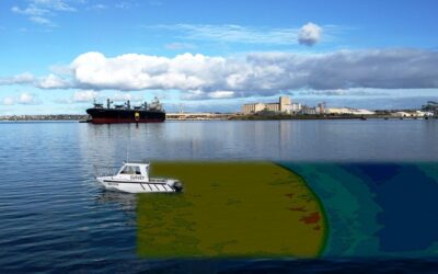
The hydrographic survey, an important civil engineering service, determines the physical features in an underwater area. A hydraulic survey is similar to topographic or ground surveys and uses special equipment to measure the water body to support marine construction.
Are you familiar with the types of hydrographic surveys that are required for certain projects? Continue reading to learn more about how hydrographic surveyors map the floors of rivers and lakes and oceans.
Hydrographic Surveys
When someone wishes to make significant changes to the area’s water, hydrographic surveys are required. These include projects like:
- Docks and marinas are being built
- Dredging
- Waterway planning
- Water diversion
- Removal of soils
- Location of the wreck
These projects require that all teams have a detailed understanding of the site layout. Imagine building a house on a piece of land and then finding a huge ditch in the middle. This is how it would feel to begin a water-based project in the absence of a hydrographic survey.
Water Depth Estimation
Hydrographic surveys are used to determine the depth of water bodies. Parties involved in a construction project need to know the depth of their building.
Water depth is also a crucial point of information for maritime navigation. Water bodies are filled with irregular soil deposits, coral reefs, and hidden obstacles that could pose a threat to ships traveling through them. Surveys are often used in port planning and construction to determine the water depth that is needed to accommodate the largest ship possible. This is crucial for shipping safety as 80% of international trade in the United States is done through the maritime transportation system. It is crucial to be able to tell where a vessel can navigate, given the number of ships that come into and out of ports.
Project Results
Another practice is to have the area surveyed before and after the project is complete. If a river needs to be dredged, the team would send a survey crew to take a picture of the riverbed and any sunken objects. The team would bring back the survey crew to see the results of their dredging.
Underwater Hydraulic Survey
Equipment
Hydrographic surveys began in the 1800s when fishermen tied a weight to a rope to see how far they could reach the bottom. Technology has advanced to the point that water movement does not affect survey accuracy.
Sonar is the primary resource used by survey crews. It is a system that uses sound waves to bounce off objects and determine their distance when they reflect.
These are two of the most common types of sonar used in surveying:
- Single-beam sonar uses one transducer to transmit and get pings from a particular area.
- Multi-beam Sonar employs multiple single-beam transducers rather than focusing on one point.
It is helpful to think of each sonar as a flashlight or floodlight. A flashlight allows you to focus large amounts of light on one point while a floodlight can see more, but you have less detail than the flashlight. A multi-beam gives you a broad view of large areas, while a single beam allows you to focus on specific spots and see the details.
The Process
Each hydraulic survey is done onboard a boat. Once our equipment is aboard, our surveyors use GPS to determine a control area. Each piece of equipment then needs to be calibrated for perfect accuracy. We then use a combination of single and multi-beam Sonar to determine the layout of each water body.


